.

Company houses, Floyd County, Kentucky: photo by Arnold Rothstein, May 1938 (Farm Security Administration/Office of War Information Collection, Library of Congress)

Coal mine, Floyd County, Kentucky: photo by Arnold Rothstein, May 1938 (Farm Security Administration/Office of War Information Collection, Library of Congress)

Mining town, Floyd County, Kentucky: photo by Arnold Rothstein, May 1938 (Farm Security Administration/Office of War Information Collection, Library of Congress)

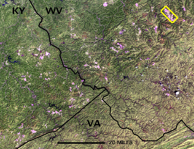
Mountaintop removal coal mining, regional distribution: Landsat satellite image showing regional extent of mountaintop removal coal mining in southern West Virginia, southwestern Virginia and eastern Kentucky. Mining operation near towns of Kayford and Marsh Fork, West Virginia shown by yellow box. Aside from a few scattered clouds at center right (bright white spots), most of the pink to white patches on this image are active or unreclaimed mountaintop removal and strip mining operations: image by Sky Truth, 7 February 2011

Valley fill: mountaintop removal coal mining, Martin County, Kentucky: photo by Flashdark, 6 June 2006
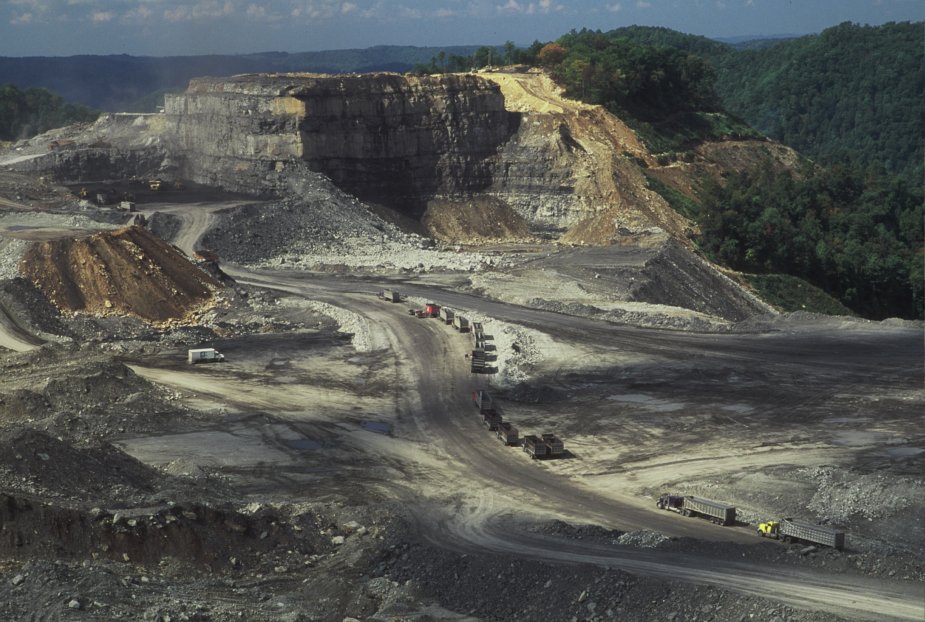
Mountaintop removal coal mining site, Appalachia: photo by The Sierra Club, 12 October 2006